Enquire Now for a free site visit – call
Introduction
Buying or verifying land in Tamil Nadu without understanding the FMB sketch Tamil Nadu record can create confusion over plot boundaries, survey numbers, measurements, and sub-divisions. This matters because FMB sketches form part of the state’s land-record system. According to the Tamil Nadu Government’s 2025–26 policy note, the Tamil Nilam Geo Info mobile application provides access to A-Register, FMB sketches, and Patta details, while geo-referenced cadastral boundaries have been completed for rural areas. For buyers, the challenge lies in understanding what the sketch represents and how it connects with other property documents. This guide explains the FMB sketch Tamil Nadu, its measurements and boundaries, and what buyers should verify before making an important property decision.
What Is an FMB Sketch in Tamil Nadu?
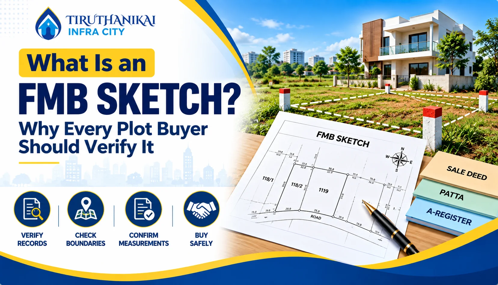
An FMB sketch Tamil Nadu is a land measurement record that visually represents a surveyed property and its boundaries. FMB stands for Field Measurement Book, which contains survey-related measurements and parcel details. Property owners and buyers can use this information to understand the recorded shape, dimensions, and sub-division of a land parcel. Tamil Nadu has also moved these records toward digital access. The Tamil Nadu Government’s 2025–26 policy note states that the Tamil Nilam Geo Info mobile application, launched in January 2025, provides access to A-Register, FMB sketches, and Patta details. The same policy note states that geo-referenced cadastral boundaries have been completed for rural areas.
Meaning of FMB
FMB means Field Measurement Book. In simple terms, it records survey measurements that help represent individual land parcels and their boundaries. When you look at an FMB sketch of Tamil Nadu, you can understand how the survey system records a particular parcel, including its measurements and sub-division details. Tamil Nadu has increasingly connected these land records with digital mapping systems. The 2025–26 Tamil Nadu Government policy note reports that geo-referenced cadastral boundaries have been linked with the Tamil Nilam database and Registration Department guideline-value information. FMB sketch Tamil Nadu It also states that this work has been completed for rural areas. For a property buyer, an FMB sketch Tamil Nadu helps you understand how the land appears in survey records. You should compare it with your sale deed, Patta, and other relevant documents before making a property decision.
What Does an FMB Sketch Show?
An FMB sketch Tamil Nadu gives you a visual representation of surveyed land and helps you understand the recorded measurements and boundaries of a parcel. The exact information can vary according to the property and available records, but an FMB sketch commonly helps you identify:
- Survey number – identifies the relevant surveyed land parcel.
- Sub-division details – identifies a specific portion created from a larger survey parcel.
- Measurements – shows recorded dimensions associated with the parcel.
- Boundary information – helps you understand the recorded limits of the land.
- Parcel shape – provides a visual representation of the surveyed area.
- Related survey references – helps connect the sketch with other land records.
Tamil Nadu’s 2025–26 policy note states that its Tamil Nilam Geo Info application provides access to FMB sketches along with A-Register and Patta details. The state has also completed geo-referenced cadastral boundaries for rural areas, strengthening digital access to spatial land information.
Why Is an FMB Sketch Important?
An FMB sketch Tamil Nadu can help property owners and buyers understand the recorded measurements and boundaries of a land parcel before making important decisions. It becomes particularly useful when you need to compare survey information with other property documents. For example, imagine you plan to buy a residential plot. The seller gives you a sale deed showing a particular survey and sub-division number. You can compare those details with the available FMB sketch Tamil Nadu to check whether the recorded measurements and parcel configuration appear consistent. Another example involves an existing property where the physical boundary seems different from the recorded information.
The FMB sketch can provide useful survey information for further verification. Tamil Nadu’s 2025–26 policy note reports that the state has completed geo-referenced cadastral boundaries for rural areas. It also states that the Tamil Nilam Geo Info application provides access to FMB sketches, A-Register, and Patta details, making these records easier to review.
Why Do You Need an FMB Sketch in Tamil Nadu?
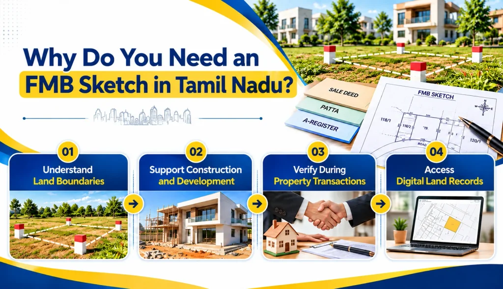
An FMB sketch Tamil Nadu helps property owners, buyers, and developers understand the recorded measurements and boundaries of a land parcel. It becomes useful when you compare survey details with your sale deed, Patta, or other land records. According to the Tamil Nadu Government’s 2025–26 policy note, the Tamil Nilam Geo Info mobile application provides access to A-Register, FMB sketches, and Patta details. The state has also completed geo-referenced cadastral boundaries for rural areas. These developments make land information easier to review. An FMB sketch Tamil Nadu can support property verification, construction planning, boundary checking, and land transactions. Always compare it with other relevant documents before making an important property decision.
To Understand Land Boundaries
Land boundaries can become confusing when physical measurements differ from property documents. An FMB sketch Tamil Nadu helps you understand the recorded layout, measurements, and boundaries of a surveyed land parcel. You can compare the sketch with the actual site to identify possible differences in dimensions, survey numbers, or sub-divisions. For example, suppose you plan to purchase a 2,400 sq. ft. plot. You can compare the available survey information with the physical site before proceeding.
If the measurements or boundaries appear different, you can seek professional or official verification. According to the Tamil Nadu Government’s 2025–26 policy note, the state has completed geo-referenced cadastral boundaries for rural areas. This development supports better digital access to spatial land information and makes boundary-related verification easier.
For Construction and Development
An FMB sketch Tamil Nadu can support construction and development planning because accurate land measurements help professionals understand the site. Tamil Nadu’s building-approval process requires important property details such as the survey number, sub-division number, and site extent. Certain approval requirements also include an FMB copy or Town Survey Map along with other land records.
| Construction Stage | How FMB Information Helps |
|---|---|
| Site verification | Helps compare recorded details with the actual site |
| Planning | Helps understand the property’s recorded dimensions |
| Building application | Can form part of supporting land documentation |
| Boundary checking | Helps understand the recorded parcel configuration |
| Development planning | Provides useful survey-related information |
For example, before constructing a house, an owner can compare the available survey information with the physical plot and provide the relevant details to an architect or registered professional. This can help reduce confusion during planning.
During Land or Property Transactions
An FMB sketch Tamil Nadu can help buyers and sellers cross-check important land details during a property transaction. A buyer can compare the survey number, sub-division, measurements, and boundaries with the sale deed and other relevant records. This process can help identify inconsistencies before completing the transaction.
For example, imagine a buyer wants to purchase land under Survey No. 125/2A. The buyer can compare this survey and sub-division information with the available FMB sketch Tamil Nadu and other property documents. If the recorded measurements differ from the physical site, the buyer can seek professional or official verification before proceeding.
Tamil Nadu’s digital land-record initiatives have also improved access to records such as FMB sketches, A-Register, and Patta details. These records can provide useful information, but buyers should review the complete set of relevant property documents rather than relying on one record alone.
Common Problems Related to FMB Sketches
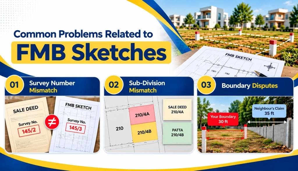
Understanding an FMB sketch Tamil Nadu can become challenging when the information differs from other property records or the physical site. Buyers and landowners may face issues involving survey numbers, sub-divisions, measurements, or boundaries. Tamil Nadu has digitized several land records to improve access and verification, but users still need to compare information carefully. Common problems include outdated records, incorrect references, unclear measurements, and differences between documents. These issues can create confusion during property purchases, construction planning, or boundary verification. Before making a decision, compare the FMB sketch Tamil Nadu with the sale deed, Patta, survey details, and physical property. If you notice a significant difference, seek appropriate professional or official verification.
Survey Number Mismatch
A survey number mismatch occurs when the survey number shown in an FMB sketch Tamil Nadu differs from the number mentioned in another property document. This issue can create confusion during property purchases, construction approvals, or land verification. For example, imagine a sale deed mentions Survey No. 145/2, while the available FMB information refers to Survey No. 145/3. You should not assume that both references describe the same property.
Before proceeding, compare:
- Survey number in the sale deed
- Survey number in the FMB sketch
- Patta details
- Sub-division number
- Physical location of the property
A mismatch does not automatically mean that someone made an error. Changes in survey records, subdivisions, or historical documentation may explain the difference. Proper verification can clarify the actual record.
Sub-Division Mismatch
A sub-division mismatch occurs when the sub-division number in the FMB sketch does not match the number shown in the sale deed, Patta, or other land documents. This matters because one original survey number can contain multiple sub-divided parcels. For example, a property document may mention Survey No. 210/4A, while another record shows 210/4B. These references can represent different portions of the original survey parcel.
When you notice a mismatch, check:
- Parent survey number
- Sub-division number
- Recorded land extent
- FMB measurements
- Related revenue records
- Physical property location
Do not rely only on the matching parent survey number. The specific sub-division can identify the portion connected to the property. If the details remain unclear, seek appropriate official or professional verification before purchasing or developing the land.
Boundary Disputes
Boundary disputes can arise when the physical limits of a property do not appear to match the information in the FMB sketch or other land records. Differences in fences, walls, pathways, neighbouring plots, or recorded measurements can create disagreements between property owners.
For example, suppose your documents indicate a 30-foot boundary, but a neighboring owner claims that the boundary extends several feet into your property. Instead of relying only on the existing fence or verbal claims, compare the FMB sketch, survey information, title documents, and physical measurements.
An FMB sketch Tamil Nadu can provide useful recorded measurement information, but it should not serve as the only basis for resolving a serious dispute. When records and physical boundaries conflict, a qualified surveyor or appropriate authority can help verify the actual survey position and clarify the issue.
Common Mistakes to Avoid When Checking an FMB Sketch
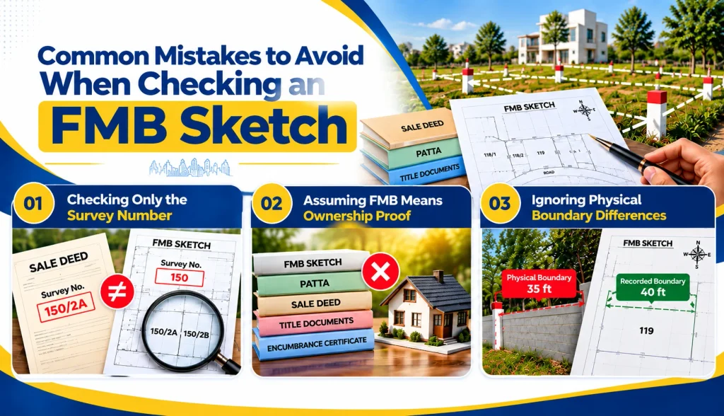
Checking an FMB sketch Tamil Nadu requires more than matching one number with your property document. Many buyers focus only on the survey number and overlook sub-divisions, measurements, boundaries, and the actual site condition. This approach can create confusion during property purchases or construction planning. Tamil Nadu’s digital land-record initiatives now provide easier access to FMB sketches, A-Register details and Patta information, but you still need to compare the records carefully. Common mistakes include checking only the survey number, treating FMB as ownership proof, ignoring physical boundary differences, and skipping professional verification when records conflict. A careful comparison can help you identify discrepancies before making an important property decision.
Checking Only the Survey Number
Checking only the survey number can lead to confusion because one survey number may contain several sub-divisions. When you review an FMB sketch Tamil Nadu, you should examine the complete survey reference rather than matching just the main number. For example, imagine your sale deed mentions Survey No. 150/2A, while you check only “Survey No. 150” in the available records. You might accidentally assume that the information refers to your exact property when several portions exist under the same parent survey number.
Always compare:
- Survey number
- Sub-division number
- Land extent
- Recorded measurements
- Property location
- Relevant revenue records
For example, 150/2A and 150/2B may represent different portions of the same larger survey parcel. Checking the complete reference gives you a clearer picture and reduces the risk of comparing the wrong land parcel.
Assuming FMB Means Ownership Proof
An FMB sketch Tamil Nadu provides survey-related information, but you should not treat it as standalone proof of property ownership. The sketch mainly helps you understand recorded measurements, boundaries, and the configuration of a surveyed parcel. Ownership depends on the relevant title and legal documents.
| Record | Main Purpose |
|---|---|
| FMB Sketch | Shows survey measurements and parcel configuration |
| Patta | Provides relevant revenue record information |
| Sale Deed | Records the property transaction |
| Title Documents | Help establish the ownership chain |
| Encumbrance Certificate | Provides information about registered transactions affecting the property |
For example, an FMB sketch Tamil Nadu may show the correct dimensions of a plot, but that alone does not establish who legally owns it. Review the FMB alongside the sale deed, title documents, Patta, and other relevant records before completing a property transaction.
Ignoring Physical Boundary Differences
Ignoring differences between the FMB sketch and the physical property can create problems later. An FMB sketch Tamil Nadu can show recorded measurements and parcel boundaries, while fences, walls, roads, or neighbouring structures may not always match those records today. For example, suppose the FMB information indicates a 40-foot boundary, but the existing compound wall gives you only 35 feet. You should not simply assume that the wall represents the official boundary. The difference could result from construction changes, encroachment, measurement issues, or other circumstances.
Before proceeding, compare:
- FMB measurements
- Sale deed details
- Survey and sub-division numbers
- Existing physical boundaries
- Neighbouring property limits
If significant differences appear, seek appropriate survey or official verification. Addressing the difference early can help prevent larger disagreements during construction, sale, or future property use.
Conclusion
Understanding an FMB sketch Tamil Nadu can make land verification clearer and help you avoid costly confusion. An FMB sketch Tamil Nadu gives useful information about survey numbers, sub-divisions, measurements, and recorded boundaries. However, you should not rely on it alone when buying, selling, or developing property. Compare the FMB sketch with your sale deed, Patta, title documents, and the property’s physical boundaries. If you notice differences, seek appropriate professional or official verification before taking the next step.
Whether you are a plot buyer, landowner, builder, or property developer, checking these details early can help you make better-informed decisions. Planning to verify your land? Start by checking your FMB sketch and comparing it with your other property documents today.
FAQs
1. What is an FMB sketch in Tamil Nadu?
An FMB sketch shows the recorded measurements, boundaries, survey number, and other details of a land parcel.
2. What does FMB stand for?
FMB stands for Field Measurement Book, which contains survey-related land measurements.
3. What information does an FMB sketch show?
It generally shows the survey number, sub-division, measurements, boundaries, and parcel configuration.
4. Is an FMB sketch proof of property ownership?
No, an FMB sketch provides survey information and does not independently prove property ownership.
5. Is FMB the same as Patta?
No, FMB focuses on survey measurements, while Patta provides relevant revenue-record information.
6. Why is an FMB sketch important for property buyers?
It helps buyers compare recorded land measurements and boundaries with their property documents.
7. Can an FMB sketch help identify land boundaries?
Yes, it helps you understand the recorded measurements and boundaries of a surveyed land parcel.
8. What if the FMB sketch and sale deed have different details?
Compare the records carefully and seek appropriate professional or official verification if differences remain.
9. Why is the sub-division number important?
It identifies the specific portion of land within a larger survey number.
10. Should I check an FMB sketch before buying land?
Yes, checking an FMB sketch along with other property documents can help identify potential discrepancies before purchase.